The opportunity arose, one fateful week in June. My friend Jay had recently scoped some areas in the Eastern Sierras. As fate would have it, there was still some glimmering white lingering in the Sierran crest. He proposed a quick weekend trip to slay the Gilbert couloir and on that Friday afternoon, I found myself loaded in a car of gear, enroute to Cali.
[
Overview Video for those who opt not to read ]
THE APPROACH - June 28, 29
The trip out there was mainly uneventful, except for the balancing act I played with my aging car's air conditioner and the 121-degree midday heat. For most of the stretch to Palm Springs I drove with the windows down, fearing each tic of the ever-advancing temperature gauge on my dashboard. Within 9 hours I made it to Ridgecrest, our meeting spot. In lieu of my early arrival, I made use of the time to finish putting my minimalist pack together. No tent this time, just pads and sleeping bags; summer mountaineering gear made for light packs.
Jay arrived in short time and we ditched my car, heading for the hills in hasty fashion. We stopped only briefly in Bishop before setting sights on the remaining mountain highway miles of the 168. Unfortunately the moonless sky limited the incredible views that would have to wait until morning. We pulled into a meager camp slot and pitched a tent for this first night out. We passed out in short notice and in what felt like minutes, the sun crested in the horizon. A change of clothes and some nibbles of snack fueled our last preparations. We traveled the rest of the road in towards South Lake and ditched the Subaru.
 |
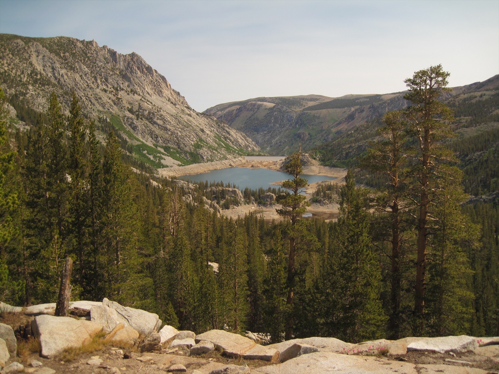
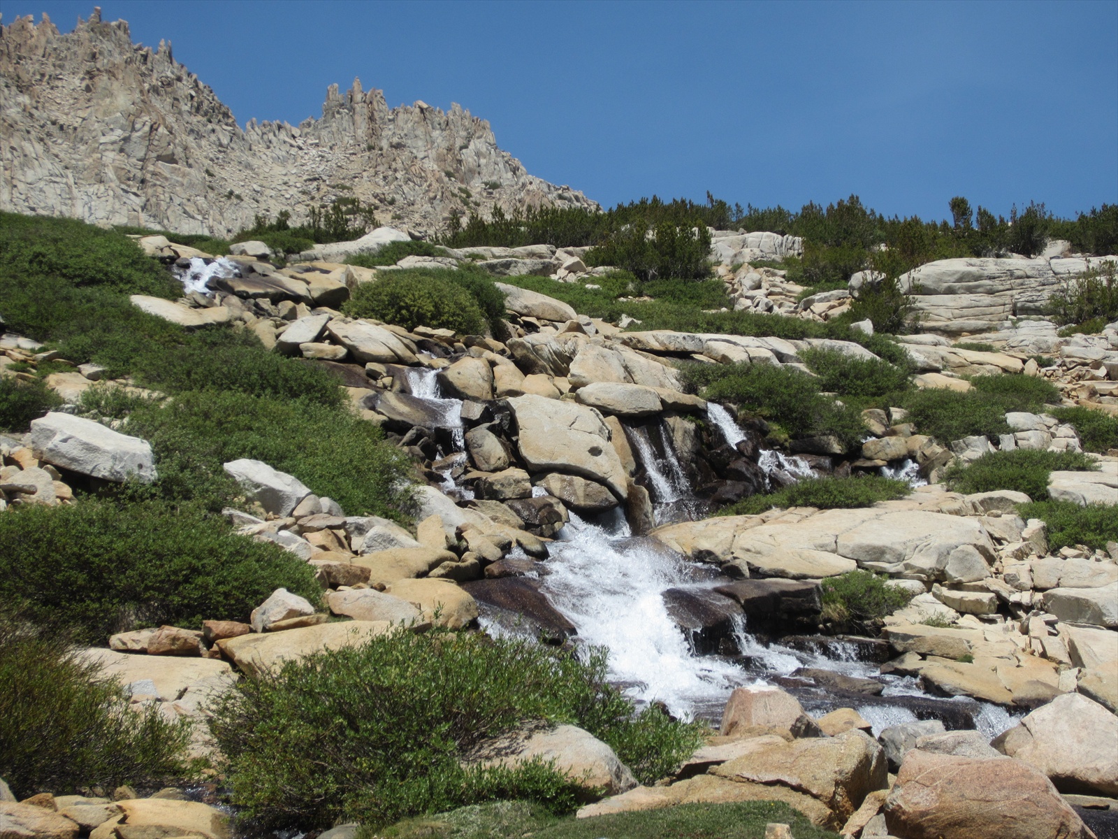
| View from the trailhead in towards Gilbert (left) and the Thompson Couloirs (right). |
We set out on the hilly trail to Treasure Lakes, slowing on the uphills and gaining momentum on the downhill sections, crossing rushing creeks and rock hopping along our way.
 |
| One of the many stream crossings. |
View back down towards South Lake (left). Mt. Hurd lingers over the Treasure Lakes region.
 |
| Looking west up towards the upper terminus of Gilbert's NE ridge. |
Before too long we arrived at the slab section, where we would deviate from the marked trail to a guessing game along a best-perceived path of least resistance to gain the upper basins.
 |
| Wild flowers out in full bloom. |
I heard you like slabs? What's that? Slabs? Of course! Let's climb the never-ending maze of slabs! *J
 |
| View to the east to Cloudripper Peak (background), Chocolate Peak (foreground) and Mt. Hurd (rightmost). |
Gilbert's NE ridge buttress and Mt. Thompson (right).
We arrived to the drainage near the 11,000' elevation lakes and stopped to refill water and refuel on energy. We feasted in anticipation of the following day that lay in front of us, with the added benefit of carrying food weight in our gut instead of on our shoulders. Two-bird win with that stone.
Must go faster, must go faster. I need to re-add as much as possible of the
already-consumed water weight back to my pack, and soon! *J
 |
This was the simplest and quickest of approach we have ever done in the Sierras, but ONLY on the way in.
The way out (which you will see later) was anything but simple and anything but quick.
We started just below the lake there in the background. |
LEFT: Chugging up the last few hundred feet of elevation to reach our accommodations for the evening. *J
RIGHT: Behold, the Gilbert / Thompson basin.
 |
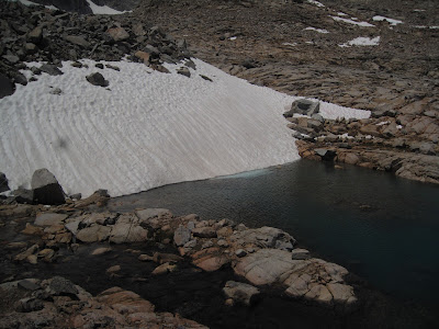
| Mt. Gilbert's North Couloir - That melted region in the middle would prove to ensure a spicy next day! |
We arrived at the main lake, just above 11,600' at around 11am that morning. I thought we were dogging it on the way up, but that turned out to be one of the easiest approaches compared to many other offerings in the Sierras. We scouted a first camp nestled out of the wind between some rocks. Unfortunately, there were no tall features to shade from the full heat of the sun. It was after all, one of the hottest weekends that summer with the timely heat wave settled in with high pressure. It was only a matter of time that we would seek out respite from heat stroke in the nearby alpine lake. I wasn't about to pass on the opportunity to jump into a lake nestled in the mountains above 11,000'.
 |
| Holy cow, it was frigid. |
Jay followed suit, in a rather unconventional manner, ditching all his clothes.
He opted for the more intimate experience with the bobbing miniature glaciers floating nearby.
 |
| Best water slide EVER! |
 |
| Welcome home. First camp of the day with the couloirs of Gilbert and Thompson in clear view. |
Did I mention it was barely noon and we had already finished the approach to high camp. Rather than explore too much, we opted to stay out of the heat and rest up for the next day, acclimating along the way. I thought our time spent on Rainier's Curtis Ridge earlier in the month in the full sun was awful. This was slightly worse -- I left the sleeping pad at home for this trip.
 |
| Passing the time oh so slowly. |
I opted to put on my light-colored solar hoodie and thermal shirt to combat those UV rays of intensity. We sweated out the remaining hours of the afternoon until a small storm system threatened to bathe us in our exposed campsite. We hastily packed up everything and stashed our packs only to find the storm blow back over to the east -- what a waste. On the plus side, now that everything was packed back up, we searched for a better campsite. We were expecting to run into one of the Sierra Mountaineering groups that had tentative plans to climb the same couloir, but with no one in sight for the day's entirety, we settled on a camp nestled just above the lake shore.
Cozy and ready for the sun to set. Any minute now...
 |
| Our bivy ledge for the night, overlooking the scenic lake waters. |
 |
| Sunset from our sleeping bags |
THE CLIMB - June 30th
We slept in until about 6am, as I recall, made short order of breakfast and last minute packing of the essentials. We set of on a meandering course skirting a couple lakes, tiptoeing across some precariously balanced boulders the size of small cars. I remember how warm it felt that morning, contrary to what I was expecting -- a perfect precursor for climbing ice during a heat wave!
 |
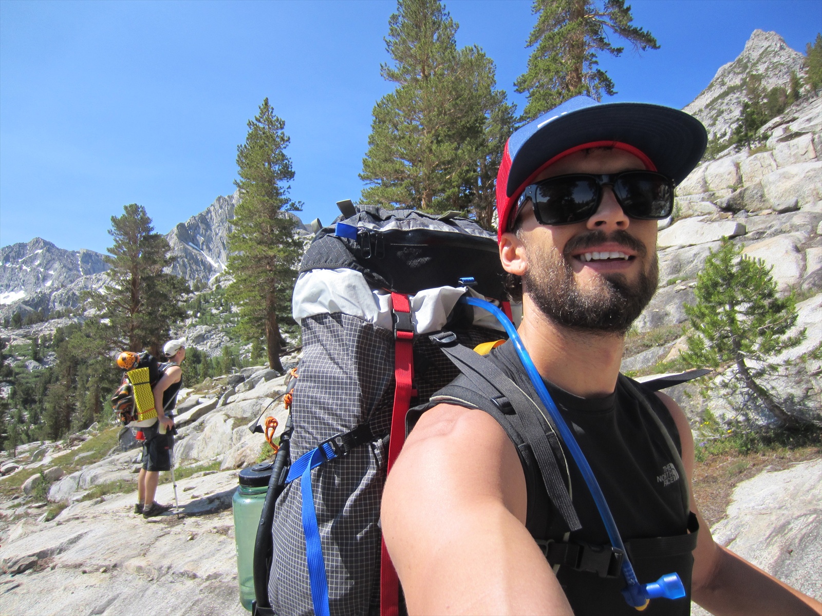
| Rock hopping our way along the basin to the start of the route. *J |
 |
| Remnants of a once glacier-hopeful snowfield. |
 |
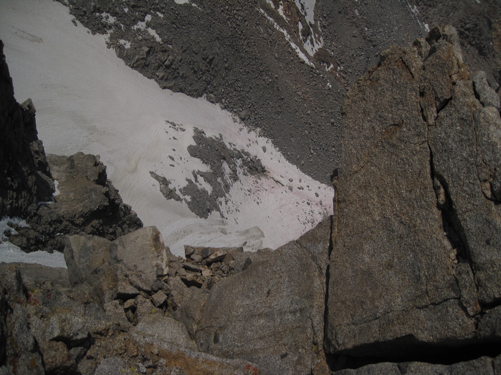
| THIS PICTURE IS SO IMPORTANT. Jay and I owe our lives to this photo which we later scoured on my camera preview window, trying to place where we were on the descent ridge in proximity to the "supposed" established first rappel station. Using this photo, we were able to determine that we still had another hundred feet to descend on the ridge before the actual "cliff out" that housed the escape rappel route that we would not be able to get down or back up. |
 |
| Jay skirting the ridge towards the North Couloir on the far right. |
 |
| A decent pick to understand the scale of the monolith. Only a little further until we reach the route. |
 |
Gilbert Couloir. Or shall we go ahead and just call it what it is with that
melted-out mid-section... the Gilbert mixed couloir. |
 |
| And so it begins. Jay takes point, while I finish flaking out the rope to tow behind me. |
Soloing the easy snow slope, rope in tow, crossing our fingers for alpine ice. *J
Alright, now the exposure is starting to come into focus.
 |
| Jay soloing on up to the rocky mid-section. |
 |
| Nearing the melted section about a third of the way up. *J |
 |
| Jay takes first stab at the rock section. It was still low-angle enough to not warrant the rope just yet.
|
 |
I followed, taking a left-variation, which was a narrow
strip of ice, hollowed-out in its center.
Looking back, it probably was not
the smartest of moves off-belay, but I pieced together the fragile moves. |
 |
By the time I made it up to Jay, he had our first belay station built
with a couple of cams nestled in between some large blocks. *J |
 |
| Making quick work to lap coil our mess of rope. |
 |
| On belay! Perched on the side of a narrow ledge below some interesting loose block climbing. |
 |
Jay, solid as can be, took first lead out (and all of 'em for that matter).
He made nice work of scraping granite in crampons. |
 |
| Looking back down at the chimney we stemmed up. |
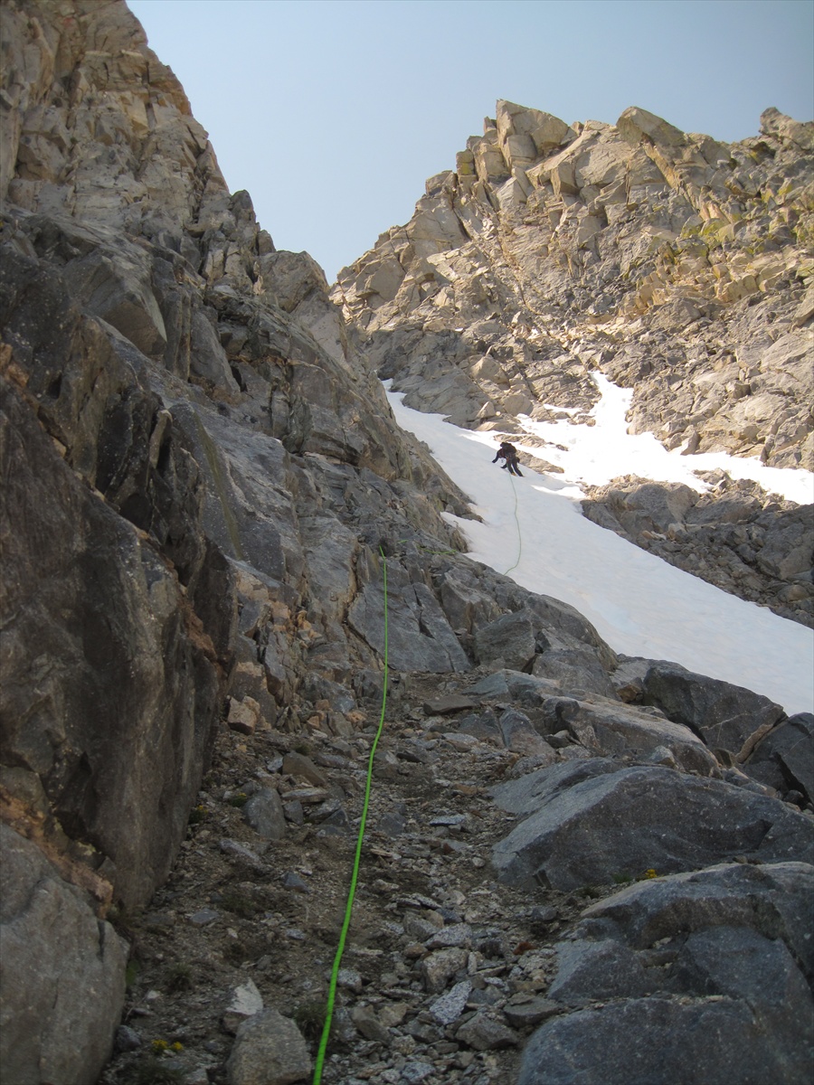
After two full pitches on the rock we finally skirted back over to the snow, which revealed a bulletproof hard base of ice lying a foot beneath it. The snow was quickly melting into slush from the intense morning sun and fortunately, the ice beneath offered a nice sturdy surface to adhere to. Jay and I soloed up the rest of the snow-covered ice until it turned into frozen mud.
 |
| Looking down the route! Aye. |
At the start of the final pitch, the remaining ice was thick, frozen mud that fractured into large chunks of debris. We decided to build a belay to the right of the couloir, out of the fall line, perched on a small ledge. Jay wanted lead again and I had no problem soaking in the views while he dealt with placing mixed protection into the last pitch! He sunk an ice screw into the mud about ten feet out and from then on, I recall perhaps one more cam. From what I recall, it was fairly steep and uncomfortable. With every swing, a large chunk of frozen mud would fracture and fall. Usually there was a better placement every tenth stick -- I just made sure to savor each one and always keep my toes firmly planted.
Finally topping out on the couloir route! What a relief to be finished with the frozen mud! *J
We took a break at the saddle above the couloir to refuel and hydrate and discuss our plan of attack for the last remaining bit of rock climbing. We opted to finish the route, true to its original intent, instead of traversing down and around the backside from the saddle. We were committed.
 |
| The final two pitches were rated 5.6 alpine rock, with a fun chimney full of smeared mountaineering boot placements. *J |
 |
| View back down the couloir to the north. |
 |
| View looking out the other side of the saddle to the south. |
Jay once again, led the first pitch up the chimney to a small cave below a giant chockstone. I followed and we were met with a bit of a next hurdle. Looking back, I think the route might be to the left of this seemingly-blank face. However, we chose to climb this instead... in the boots, remember. Jay led and I followed, hauling the packs up each section with a line of rope out from my harness.
 |
| The final crux rock pitch under the chockstone. |
Looking over to the flat ridge of Mt. Thompson in the distance. *J
 |
| View to the north with Mt Humphreys (center), Mt. Tom (right) and Bear Creek Spire (left) at a far distance. |
After some great shenanigans had while hauling packs, I finally crept up the last bit, bags in tow. Jay had already stopped off at the summit Starbucks, had a few lattes and did a fair amount of summit store shopping by the time I arrived up at the top. Thankfully he picked me up a "I summitted Mt. Gilbert and all I got was this lousy t-shirt" t-shirt and a cool travel mug made in China. But oh what a guy, he at least waited for me to make the last walk up to the summit high point. We walked up the last bit holding hands, stopping here and there to pick up cat poop to throw off the peak the whole way there. Whoa, dang, I might have had a few too many drinks as I write this. Most of this is true.
Summit photo montage. *J (Yes that is cat poop, lower right pic. Remember, marmots don't exist)
Looking due west out across Mt. Thompson (right), Mt. Goddard in the far distance (left)
Le Conte Canyon and surrounding peaks to the south (left), with McDuffee Peak to the southwest (right)
View to the east, with Cloudripper peak, and Mt. Hurd (left). The Palisades (right)
with Agasiz, Sill, and Thunderbolt peaks, Split peak in the far far distance.
 |
| Shyeah dawg. |
 |
Yeah dawg! The official "not-summiting any high peaks since Mt. Rainier circa June 2011" dry spell is DONE!
NOTE: The above statement applies to Ben, not Jay. He hath not been quite as cursed.*J |
We finished our mandatory photo-session with the freelance photographer that we found on craigslist-Bishop and realized we should probably get down asap. The sun had started to head the opposite direction, threatening to race us to the horizon. We set off down the NE ridge, without a care in the world since we had with us a trusty description of the rappel route off this piece.
 |
Now we just have to head down that way, rock hopping and skipping to our heart's content...
until we reach the ridge. Then we'll be scared sh**less. |
 |
| Looking back up-ridge towards Mt. Gilbert (left). Mt. Thompson lies at the right. |
Now the topo we had for the descent route claimed the following:
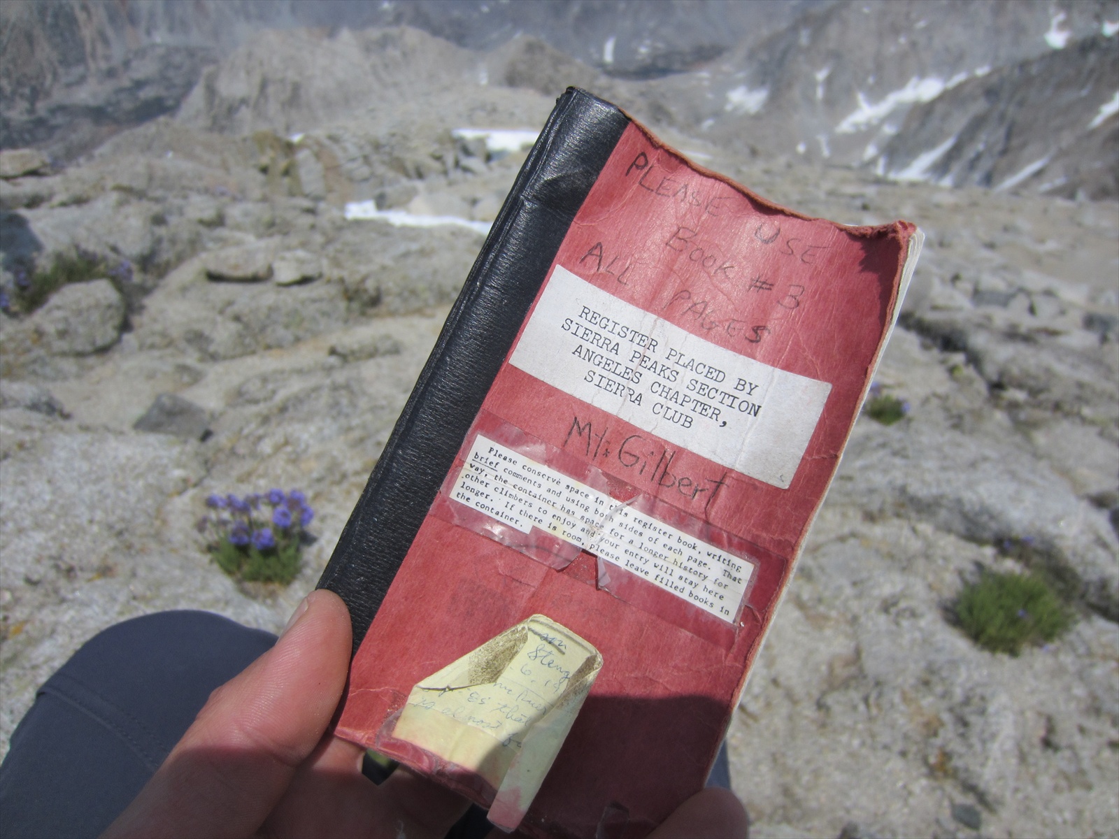
Go directly to the top of the small peak designated 12,800'. This actually has a summit register on top in an old can.
Here the ridge suddenly becomes sharp and exposed. Drop down the ridge two hundred yards or so on 4th class terrain. Just before a steep step in the ridge look for a rap anchor on the north side of the crest. Three to four half rope-length rappels lead to the snow and talus below.
Easy-peasy, right? Naw man. We find the old can atop the 12,800 peak -- an old bandaid canister. We don't bother signing, but keep moving forward into ever-exposing ridgeline. We traverse a knife-ridge here and there, using our boots to smear while working hand-over-hand. Jay and I finally come to what we think is a "steep step". We look down it and it looks like a good twenty or thirty feet of exposed step. This has to be where we'll find the rappel station, we both thought.
After a fruitless search, we debate whether to head back up the ridge to look. We must have passed it. Either way, there's no way we want to drop down this "step" and not be able to get back up if it just so happens to be the step referenced in the description. Slight uneasiness started to set in at this point and we're both arguing all sides to our predicament against that damn ridge.
Finally we get the bright idea to try and match up nearby landmarks with any pictures we might have taken that morning on our approach hike to the route, just below this ridge we're perched upon. We nestle in the shade each pouring through our cameras. We arrive at the following image from earlier:
|
THIS PICTURE
IS SO IMPORTANT!!! I TOLD YOU SO!!!
Look, there's the stinking step we're looking for.
As it turned out we were just up-ridge at that notch. Realize from
our perspective, that lil' notch there seems like a steep step! |
We finally reason with each other that we are not quite at the steep step referenced by the description. Unfortunately, we still had to find a way down what we thought was steep smaller step. We elected to sling a boulder and rappel off a tied off piece of webbing while we down-climbed this section of ridge. Any fall here would bounced us off one side or the other of the ridge. We pulled the rope and continued our exposed climbing and down-climbing of class 5 terrain until we reached a knife-ridge section that terminated -- this was definitely the steep step we'd been looking for what felt like all afternoon. "Ben, I found an anchor!" was likely the best words I had heard all day, maybe all year, maybe all life. Sigh o' relief.
 |
There's our lake in the distance, and the cars that hold
our only source of communication back to the city world. |
One of the many moments spent searching everywhere for the established rappel route. We traversed, smearing boots while our hands clung hand-over-hand along knife edges. We ducked in and squeezed out of granite boulder tunnels. The rappel route was quite the spicy affair. (*J right photo)
A look back up-ridge after finding the correct bail area. Finally, after several second-guessings, some mild retreat and un-retreat up and down the ridge, some careful analyzing of previous photos we captured with the camera earlier that morning, we located the first "established" rappel station.
Jay set the first rappel, backed up the anchor with our own webbing, and rapped. We discussed where he should find the next anchor, but somehow there was nothing. After a good fifteen minutes of a fruitless search for the next anchor, we agreed that he should find a different anchor and we'd have to build it ourselves. Jay took himself off belay and anchored into a couple cams as I rappeled the section to him. Coming down I looked all around and found nothing. I agreed to go out a little further in search of the elusive next anchor as far as I could to the ends of the rope (thankfully knotted on both ends).
I found what seemed to be a decent block that we could sling and build off of. I took myself off-belay and anchored into this third anchor and pulled some of the rope so I could belay Jay over to me. We both agreed that he should pull the rope from his location due to some pinch points in the blocks above me. He tied in to part of the pull-side of the rope that I had on belay and pulled the rope. After a couple minor snags here and there, the rest of the rope came tumbling down. Big sigh. We were now committed to building our own set of multipitch anchors on this wall. We no longer cared about leaving gear on the wall -- we just wanted to get back down to the snowfield below safely.
 |
| Rappeling out into unknown terrain. Looking out across the ridge face. |
 |
| Best photo capturing the true essence of the situation. We're so done with this crap. *J |
Jay was pretty wiped by this point, after having dealt with some sketchy first rappel after a whole day of leads. I offered to take the lead on the rest of the rappels and there was no objection. We both realized neatness would count on the rest of the rappels -- the last thing we could afford was a stuck rope up here. While Jay was traversing over to me on belay, I walked back to take in some tension. I glanced over to my left and there it was, the THIRD ANCHOR, not five feet from where I had built our improvised rappel anchor. I shared the good news with Jay and he continued the traverse over to me and then onto our newly-found anchor. We were back on route, after skipping the second established anchor station.
Jay set himself, put me on belay, and I traversed over to him. We were back on track. I made quick work of slinging the rope and setting the next rappel. I went out over the edge in search of the fourth anchor. Sure enough a slight stroked of bad luck ensued as I realized I was about 10' away from the next rappel station. I pulled a sort of "King Swing" move and fought against the pull of the rope, swinging over to the station after locking off the rappel. Made it. I shouted up to Jay to drop down a different direction from above so he would align with the next anchor. He pulled the rope while I backed up the established rappel anchor comprised of a couple wedged nuts, equalized in tandem. Jay took the next rappel down to some easier-sloping terrain and I joined him soon after.
 |
| Brake strand connected to the braaake hand. Wait, how does this work? Just kidding.*J |
 |
| We found one last anchor on the wall, despite the slope angle being fairly gentle |
 |
After another ten minutes we finally arrived at the base of the ridge,
just as the sun set over the distant horizon. |
We had exhausted the daylight in that day, from sunrise to sunset. We retraced our steps back to our previous night's camp, where the rest of our gear was stashed. Head lamps on.
After maybe an hour of stumbling through the dark across slippery, icy boulders we arrived back at camp. We filled up water for the first time after running out on the summit, several hours prior. Oh my, that water tasted exquisite.
What ensued was the long hike out. I believe it was about nine o' clock when we set out from camp in search of the trailhead. We continued down the drainage, hoping to minimize the route-finding, sticking to the simplest terrain that we could make out in the pitch black night. We became lost several times while searching for the return trail, but made the most of each other's company, pushing each other to keep moving forward. We debated a few times whether to just sleep for the night until the sun came up.

Knowing that our wives back home were likely worried, we kept pace
moving in a downward direction. One of our decisions on directions
eventually came down to triangulating our position using the north star,
the siliouette of Mt. Hurd, and the buttress of the NE ridge behind us
to figure out if we had passed the section of trail that crosses one of
the major creeks. As it turns out, that last lil' bit of navigating was
enough to lead us to the well-marked trail out. Another mile or two and
we finally arrived at the cars, just before 2am. We pulled a twenty hour
summit day.
We drove back in to Bishop, called the wives, found a cheap motel to crash at, and slipped safely into unconsciousness. The next morning we began the return trip, ever relieved to be back safe.
Wiped. I was supposed to be back to Phoenix, and back to work by this time. But first, we had to stop at Schat's Bakery for some grub! Until next time.
PS: Thanks to all our family back home who worried about us -- we're relieved we were able to safely get down, despite being almost half a day late on our call-by time. Love you all.
Photo Credits: All photos are mine except for those denoted by *J, signifying the class-act photography work of mister Jay P. True class act of all class acts.


2 comments:
We have got to do this more often!
Amen, brotha! The winter season is calling. I shall be ready!
Post a Comment