New video (as of 3/27/2011)
First Attempt at Mt. Whitney (Inyo National Forest)
Until I can muster up the energy to give a TR, here are some pics to wet the appetite...
 |
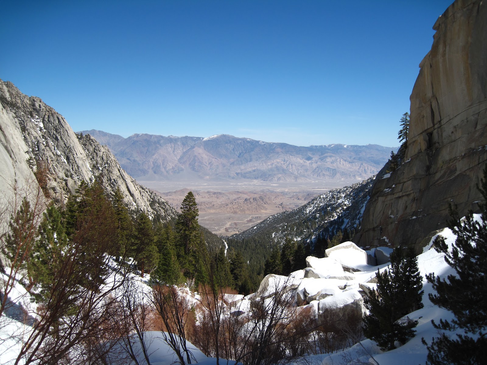
| Mount Whitney and the Needles looming in the distant ridgeline. Thor Peak at the center. |
Some intersection near Edwards AFB, where the 395 crosses an actual paved highway. Quite the picturesque restaurant.
 |
| On the drive in at sunset, this huge lenticular cloud sat above the southern end of the Sierras, just over that hill. |
Click to see more...
Our camp for the first night, along the Portal road. Jay N. keeps warm in his bivy while Jay P. begins breaking down camp.
Breaking camp... a mere 6 hours after we set up. Bears are supposedly quite active here too.
My pack before distributing some of the group gear. Originally 83 lbs, dropped it to 76lbs for the second day.
Hiking the small portion of the Whitney main trail. It's so close I can almost touch it.
 |
| The main trail snakes through the valley south (left) of Thor peak (pictured right), while the Mountaineer Route ascends through the North Fork of Lone Pine creek, to the north of Thor. |
 |
| One of our many breaks that day. Walking dirt trails with snowshoes sucks! |
 |
| Finally we arrive at our fork, where we'll be making our own trail for the rest of the trip up to the Sierra Crest. |
Key take-aways: "This is not the Whitney trail", "NOT EASY", "Safety is YOUR responsibility". Oh boy.
 |
| Some artistic shots to kill time while letting our breath catch up. |
SPOT... our only link to the outside world. . . And, we're off!
 |
| Entering the Ebersbacher ledges portion of the climb. Usually a maze of messy willows and gigantic boulders, the heaps of snow, creates a nice passage way right over top! Just gotta watch out for the melting snow bridges, where a fall through the snow could mean drowning in an underground river rapid. We found bypassed several! |
Some dude taking a picture of a dude taking a picture of anotha dude! Ah, the sweet Sierra wilderness
 |
| The granite here is amazing! |
Continuing on into the gully. An example of what's buried beneath the snow. Spring conditions are abundant!
 |
| A peak back down into Owens Valley and the road we entered in the night before. |
Finding time to rest. Despite taking our time, we still were feeling the heat and the exhaustion from carrying 70lbs in the midday sun.
 |
| The final 200 feet before topping out to Lower Boyscout Lake: high camp for night two. Thanks again to Joel for coming down and helping me carry my pack for those last hundred feet or so. So grateful. |
 |
| Enjoying sunset at high camp as the sun sets between the plateau spires of Iceberg lake above us. |
Time to get cookin'. I'm pretty sure all of us feel like crap that evening.
 |
| Sunrises over Owens Valley... Instead of heading down, Mark and I decide to go for it, albeit late. |
Impressive rock formations surround Lower Boyscout Lake, some of which has already melted back to its usual state.
 |
| We're heading straight up, past the blue ice formations, veering right and then left, crossing under the spires of the Iceberg lake plateau. I swear, it looks so close... |
 |
| Steady pace behind Mark, with others climbing towards Upper Boy Scout Lake. |
Looking down at our progress, you can see LBS lake below and our camp through the trees.
Behold, our lovely high-camp.
 |
| Amazing blue ice forming below the drainage from Iceberg lake. |
The final bit of slope before arriving at Upper Boy Scout lake. Iceberg lies just beyond the spires. We'll traverse left of them.
The trees are starting to thin out, showing just how harsh this terrain and environment are.
 |
| Poor lil' fella. |
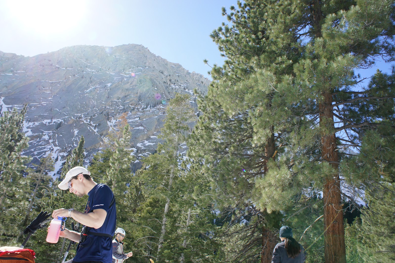
Checking in from Upper Boy Scout Lake!
Mark in high spirits. And going through the motions of the tedious process to put harness back on after relieving oneself!
 |
| Looking northwest toward Mt. Russel, Whitney's twin 14er. UBS lake lies somewhere in that flat patch of snow. The spires of Iceberg lake now lie directly above us to the left. |
Finally, as we traverse around Iceberg lake, our first views of Whitney, since that
first morning, finally come into view. Oh man, was the effort worth this view!
 |
| Thar she is, matey! Keeler needle lies just off to her left along the Sierra Crest. |
 |
| A great shot of the Needles and Pinnacle ridge that juts out to our left. |
 |
| Now begins the fun process of finding the correct notch to ascend to Iceberg lake, to our upper right. |
We tried to ascend the first notch we found and Mark stumbled into some dangerous snow bridge territory, with a good 10 foot drop from the top of the hole down into the rushing water below. At right, looking back along our route.
 |
| While Mark down-climbed the pitch, I opted to scout out another route and climbed along some of the outcropping. |
 |
Man, I wish this shot turned out... Just to the right of those rocks is a
good 40 foot drop to the slope with another 300 feet of run-out. Exciting stuff! |
 |
Watching my partner in crime down-climb our wrong route. After getting down, we
traversed further to the lower right to the next available pitch. |
 |
| Hey-oh! Long way down. |
Left: Looking back at our tracks. Right: East Buttress face of Mt. Whitney with our new-found route up to Iceberg lake.
 |
| Watching Mark as he climbs our next alternative pitch up to Iceberg. |
 |
| What a stud. |
Annnd finally! We arrive at Iceberg lake after a good 60-degree slope with some sketchy ice. My handsome reward... none other than a friendly, hoppy brew from my fellas at SanTan in Chandler, AZ. I swear, I take those cans everywhere! Hoppy makes me happy.
 |
| Mark and I chillin' in the wind below the peak. Time to break out the puffies (down-coats). |
 |
| Epic shot of the Mountaineers Route up the north side (to the right) of Whitney. |
 |
| Thank God for cans! Hehe |
 |
| One last final shot before heading back. We were humbled by the effort it takes to climb her. |
 |
| Hey, well what do you know? Mark and I both surpassed our highest altitudes, even in turning back midway. |
Now began the even slower process of down-climbing and reversing our steps.
 |
| That's one heck of a slope with a bit of exposure... |
Even though we turned back, our spirits were high. We both knew
we'll be back. Until then, we have a lot of experience chocked up in this trip.
 |
| On the way down, I find some good wind-slab, some of which already has a fracture line spanning the width of the slope! Good thing the slab is only 2-inches in thickness and the fracture line is at the base or this could be sketchy. With any future snow fall though, this slope could definitely be avalanche-prone. |
The sun sets in its typical splendor above our camp. It's time to boil some water and cook some supper.
 |
| Leading into our final night on the mountain. Chilly and windy as soon as the sun sets above. |
Mark and I quickly divert our efforts to the culinary side of camping,
fixing some savory chicken macaroni with green onions. Delicioso!
 |
After another long night with little sleep, I set out at 5:30 to catch a glimpse of sunrise over Owens Valley and
Death Valley in the far distance. Some time with the big fella upstairs in the wilderness does the soul some good. |
 |
| The sun slowly illuminates the Sierra granite in spectacular fashion. |
 |
| The sun cresting in the east... |
 |
| ...breathing dynamic life back into frozen strands of ice. |
 |
| Back to camp to pack up and begin our Sunday morning descent. |
We made it out to the road in about 2.5 hours and we took some time to capture some good shots.
I know Yen is feeling some of the relief in being down from the mountain. She hides it well. Me on the other hand...
Poetic shot of Yen and her WAG bag with Whitney in the background. It's still four miles down to the cars from here. Thankfully Joel and co. brought his truck up to give us and our gear a ride down.
 |
| The infamous road-closed signage. |
 |
| A shot of Thor Peak as I make my way down the Portal road back to Lone Pine, enroute to Phoenix. |
From other group members' collections:
From our first night, starting at 11pm, we hiked the 3-4 miles up the icy road to our first camp at the Portal.
 |
| Low camp from first night at the Portal. |
 |
| Our group starting at the Portal trailhead. From left to right: Jay P, myself, Mark, and Yen. Missing Jay N and Joel |
 |
| There's the group. |
 |
| Weighing packs at the Portal. A great tradition. |
 |
| Man, I so thought the snowshoes would work well... Not when the trail consists of 75% rock and dirt. Ugh. |
 |
| Great shot of Jay P. topping out above the Eberbacher ledges. |
 |
| Yen resting at Lower Boy Scout lake. We eventually broke out the shovels and began building camp. |
 |
| Joel took right to the slope, carving out some good flat ground to pitch the tents on. |
 |
| Making my way up to Upper Boy Scout lake. The Alabama Hills out in Owens valley sit about 9,000 feet below us. |
|
|
|
|
|
|
|
|
 |
| Let me get a breather... Oh boy. |
 |
| Some of the crazy ice formations just below Iceberg Lake |
 |
| Me contorted on the pitch up to Iceberg. |
 |
| This made the whole approach... WORTH IT! |
 |
| Heading down with the sun quickly falling onto the horizon |
 |
| Yen wagging her WAG bag with pride! Hahaha! |
 |
| When I go, I don't need no WAG bag. |
An eclectic group of sorts!
Thank God for Joel's truck! One final group shot overlooking the Alabama Hills below.
Here's some footage from my buddy Mark Emerson:
Cheers!


No comments:
Post a Comment