Trip: 7.35 miles roundtrip, 4474 feet of total elevation gain (more stats at bottom)
 |
| Our route to the top! |
Trip to Baldy... success. Over four thousand feet of elevation gain in a little over seven miles, round trip... conquered.
As soon as work let out Friday afternoon, I headed due west. Car was saturated with winter gear, a cooler with the usual snacks and beverages, and one stoked fella at the wheel. I made great time, rolling into Palm Springs just after sunset. After correcting for the horrible route my phone gps toured me through, I found my way into the worst stretch of stop-and-go main street, I've ever experienced. Twenty minutes of slow going from one red light to the next, dodging nearly hundreds of Maseratis and nefarious Aston Martins changing three lanes at a time, and slamming on the breaks to avoid crazy pedestrians, were just a few of the notable obstacles through downtown Palm Springs. I finally found the Big Five Sporting Goods, ran inside and bought my permit to enter the San Gabriels. First sigh-of-relief. Having that piece of paper in hand took the pressure off the rest of the night. From here on, it was simply a matter of getting to LA, finding a spot to sleep along the mountain road, and wrestling some z's from the anxiousness that seemed most prevalent at that point.
. . .
After a quick bite to eat at some Chinese-wok place, I checked my map, called my lady back home and chased the pavement into the mountains. Heh, on a funny side note, my fortune cookie from dinner read something to the effect of: "Mom's advices is always the best advice." Up until that day my Madre was the biggest skeptic to the whole idea of driving out to LA... alone... to hike a mountain... in the snow. God forbid. That lil' note gave me quite the chuckle and I placed it on the dash of the car. The canyon drive into the San Gabriels was quite fun with the sharpened hairpin turns throwing everything in my car from one side to the other as I entered and exited each switchback uphill. After a few trips to the dead-end of the mountain road and back, I found a place where there were already a few like-minded souls camping in their cars for the night. I laid down the right-side seats in my Toyota to reveal a flat space, just long enough to fit my sleeping pad and winter bag. I laid back and within minutes I must've passed out cold... for an hour... at which point some back-ho tractor began driving back and forth beside my car, shining its excruciatingly bright flood-lights into my compartment. I waved at what I thought was a head-less driver, hoping to convince him to think twice before dumping me and my car off the side of the mountain. With a shrug of confusion, I slunk back into my warm mummy bag and continued on my trek to the dream state.

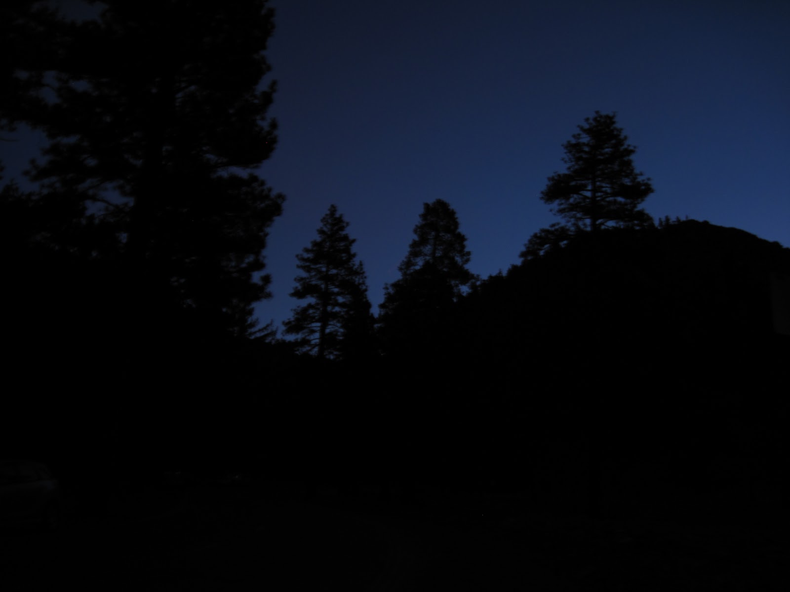
Six AM rolled in surprisingly quickly, with the ol' cell phone alarm clock reminding me of my whereabouts. I jumped out of the car and beelined to the nearest port-o-crapper and greeted the morning. Back at the car, I slowly began packing and repacking everything I figured I would need on the hike. It was still dark, but I could see that there wasn't a spec of snow near the trailhead. In fact, it looked like the snowline on the adjacent mountains was near the top. "Oh great. Cali's apparently suffering through the same dry spell, we Arizonans have been twiddling our thumbs through," I thought to myself. Once packed, I pulled out a bagel from my stash of bread and layered that sucker with a nice, thick film of peanut butter. I was so sloppy in my form that I managed to split the tip of my thumb open with the plastic knife. With a lil' blood spilled to the pavement as an offering to the Mt. Baldy spirits, I was off!


I passed several hikers and backcountry skiers prepping for their bids as I wandered along the road to the trailhead. Within minutes, I was overheated. A short stop to stow the outer hard shell fixed this and I continued on. The winds far above seemed to taunt my decision, howling through the trees far up on the ridge. I approached the San Antonio Falls overlook on the old fire access road and stopped to chat with a few of the locals. I met a wise fella, Rick, who despite this being his first time on Baldy, had a ton of beta on what to expect and look for. Thanks again Rick for pointing that first turn out to us! I also met a couple of kindred locals, Q and Collin, who were also looking to escape the bustle of the city for the serene slopes of the mountains. I hiked the first part of the trail, jumping between the two parties, chatting with each and gaining respect and comradeship for each worthy soul seeking to fulfill the same desire I too held deep within. After about a mile in, I met another fella named Mark who's hopes of summitting Whitney in the winter piqued my interest. As far as interests aligning, I couldn't have found a closer match. He and I naturally teamed up for the rest of the hike.


We hiked steadily for a couple more miles until we reached the Baldy Ski Hut. It felt like I had arrived at the mecca for alpine sport. This was the essential meeting hub of the San Gabriels, with people pouring in from all over. Backcountry skiers, alpine climbers, thrill-seekers, you name it. Mark and I caught back up with Rick from earlier and we each exchanged stories and plans as we readied our equipment to switch from trail to snowfield conditions.


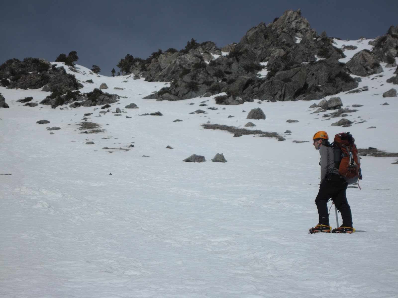
From the Ski Hut, we sat below the Baldy Bowl, staring at the large expanse laid out before us. Prior to meeting Mark, I had planned on taking the less intense, more conservative route along the left to the ridge. Having summitted Baldy before, he informed me that we would be heading directly up the center of the bowl, pointing to a pair of rock stripes forming an "11" shape on the terrain. From this perspective, the ascent that lay before us didn't seem too daunting. The bowl sort of envelopes the landscape stretching from one end of your peripheral to the other. It's almost misleading how huge the bowl actually is. With our treking poles stowed and our soft shells, helmets and ice axes on, we set out over the tongue of snow that greeted our steps, like that of a red carpet... minus the, well, red. After a few steps onto the snow, we dropped our crampons onto the icy crust, stepped in, and strapped up. I kicked a few steps to ensure their tight fit and within minutes, we began the long zigzag up the slope.
 |
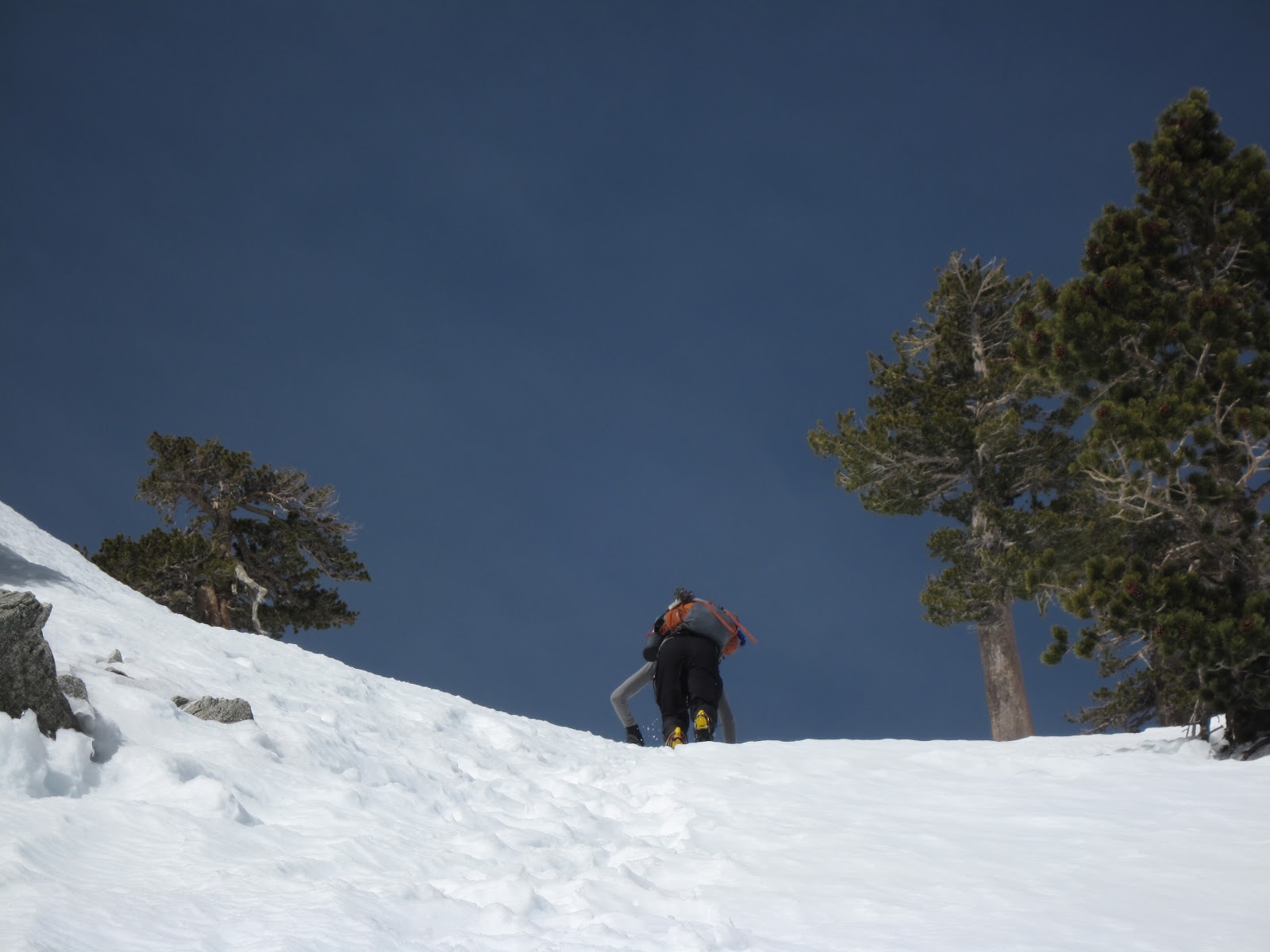
| Mark leading the route. It's still a long way to go... |


The slope was quite gentle at first, but before too long, we were ascending quite rapidly. Like a parabolic, even exponential curve, we slowly bit into steeper and steeper crust. Looking back, the landscape of trees quickly retreated and the perspective of how much elevation we were gaining seemed to catch up to our senses with each glance back down the hill. We stopped multiple times to take some pictures of the surrounding mountains that gained clearance with each higher step. Mark and I traded off leading, carving switchbacks up the crisp and sticky snow. Conditions today were phenomenal: Absolutely zero post-holing; the crampons bit well into the crunchy, icy snow; it even facilitated some front-pointing technique in ascending the slope directly. I steadily switched between a French method of cross-stepping and the German aggressive front-pointing -- it was just steep enough where each style felt relatively comfortable, without too much burn out in one muscle group.


 |
| Our route straight up the middle of the chute pictured at center. |


Several other climbers followed our tracks up the southeast face of the bowl at a steady pace, just below us. Another fella in just a t-shirt, pants and helmet quickly ascended to our right, disappearing up one of the hidden chutes near the top. At the top of the "11", Mark and I scoped out our route to the ridge. We ended up veering to the right for a little ways to jump into one of the steeper chutes. I believe he said this was his first time ascending the chute we chose that day and it proved to be challenging. Before long the climbers below us caught up to our elevation by veering left. We exchanged shouts and smiles back and forth. We continued up steep terrain, where the slope began to reach upwards of 30 and 40 degrees. I estimated with my axe and hanging leash and I could have sworn the slope seemed to get into the 45 degree aspect. At this point, I opted out of reaching into my pack for my slope reader / protractor just for the sheer risk of loosing something, albeit myself, down that steep, icy chute. I gained a good lead on Mark and turned around to monitor his progress below. I sunk my heels into a shelf I had carved out and leaned backwards onto the slope behind me to wait for him. He shouted a few times how my long strides in the snow threw off his timing completely, and I apologized for not being shorter ;-).


When he got close, I began to shift my weight around to be able to safely turn back into the slope. I turned to the right, pulling my left leg out from the shelf and swinging around my pivoting right boot. Before I could even steady myself, I leaned too far into the slope and my right boot pulled out from the snow. With no points planted to secure myself, sure enough, I began a quick slide down on my right side. LUCKILY I had been planting the point of my axe uphill during each stop and my attached leash kept me from continuing downhill. Mark yelled something to the effect of "you'd better not hit me dude" below me and I carefully kicked my points back into the slope, using my axe as leverage. Within minutes he caught up to me and we glanced up at the last 100 to 200 feet that separated us from the ridge. This time he set out to lead the rest of the way, while I hung back. I noticed a drastic change in the snow on one side of our chute. The axe seemed to easily sink into some loose-pack snow and "clunk" on a slab of what felt like, ice. I dug down about ten inches and sure enough found a nice, thick, shear pane of faceted layer. Sure enough after a few pull tests, it felt way too risky to continue on that side. I shouted to Mark further up about my concern to stay left in the chute and he agreed. We definitely encountered the lower portion of a slab, likely ripe for slide should something trigger it. I mean, the sun alone on that hot day could have done it, just like it had happened earlier in the month, lower in the bowl.


Uncovering that faceted slab layer to the right of our route. Finally topping out at the ridge!
For those last hundred feet, we front-pointed most of the way. I even went with a high-dagger grip on the ice axe, holding the tool just under the pick and punching the pick forward into the snow to gain purchase. Although effective, my gloves started to get wet on the outside and the chill of the snowpack set into my fingers. With a few more plants and lunges, I topped out over the ridge. I threw my bag down into the shelter of a ridgeline tree and continued to watch Mark as he scurried those last steps up. We made it! Now that's a sense of accomplishment... until I turned around to see that we were still not close to the actual high point. Mark pointed into the distance and we readied our coats and gloves for the final push through the wind-blasted tundra up to the final hill.
 |
| View to the southeast, down the bowl - San Jacinto in the top left portion of shot. |

 |
| Looking down the chute, towards the Ski Hut. |


By that time in the day the sun was directly overhead, bearing intense heat on the pack. The top layers of snow were melting and then re-freezing as the wind gusted over them. This made for very awkward and painful flat-steps on the gentle slope toward the top of the peak. I swear it took forever. Mark and I exchanged fits of frustration -- he was contending with intense blisters and my ankles were wrenching from the uneven, sun-cupped snow underfoot. At last, the horizon rose higher and higher in perspective as that last bit of terrain sloped downward off the other side of the mountain. We had reached the top!


The view from Mt. Baldy was spectacular, with clear distinct views of the Sierras to the north, San Gorgonio to the east and San Jacinto to the southeast. You could even make out the LA buildings downtown, hovering above the smog layer. Unfortunately, we couldn't see the ocean or Catalina island that day with the amount of haze and marine layer situated over LA, but the views within the surrounding San Gabriel range made up for it ten-fold. We exchanged handshakes with some gentlemen already at the summit, and well wishes abound. The wind definitely was not hospitable that day and forced us to rethink our post-summit plans. We were both starving. We dropped below the high point, screamed and pointed out a huge cornice that some unsuspecting people were venturing out on, filled our bottles with some electrolyte, and then headed back down towards the ridge of the bowl to find a "safer" slope down.
 |
| View to the south, overlooking the Cucamonga Wilderness and eastern Los Angeles. |


"As for me, well I take my gear selection very seriously, hand-picking each item, meticulously. That's why SanTan Brewery's Sun Devil Ale is among my 'Ten Essentials'!"
 |
| Mark leading our route back down the mountain. City of LA is off to the right, beneath the "cloud". |


We stowed our snow gear and pulled out the trekking poles for the remaining few miles of trail left to get back to the cars. Heading down the trail was a lot quieter since we both were kind of aloof in our own minds, trying to contend with the aches and riding out that last bit of adrenaline from our summit top-out. We arrived back at the car just after four PM. What a long day to be had. I finally cracked a beer at the car and began peeling each layer that had since become "apart of me" during that day. After exchanging contact info, we parted ways and I finished my IPA (So glad I brought San Tan brewery with me on this trip, ahhh). I threw the rest of my gear in the back and slowly made my way down the mountain, back to the city of industry and eventually to the ol' I-10. I opted out of napping and road that adrenaline high all the way back to Phoenix in record time, stopping only to take a picture of one of my all-time favorite mountains, San Jacinto, at dusk. Since I was younger, I recall the trips driving past the giant wind turbines of the palm desert -- I have always had a calling from that north face known as Snow Creek during the drive through the pass. Absolutely brutal in its size, yet so gorgeous in beauty. Perhaps one of these days I'll attempt the 10,000 feet of vertical gain that that route offers. For now, it's simply a nice thought and a fond memory from childhood that lead me home, heart and mind brimming with inspiration for the next experience.


 |
| Snow Creek north face of San Jacinto - Palm Springs, CA - Maybe someday. |
 |
| Final sunset over San Jacinto |


Detailed account of the route from GPS - on right, the steepest section of the ascent in the chute.
Mt. Baldy, CA - Winter Ascent from Ben Watson on Vimeo.
Thanks again go out to Mark for showing me the ropes on this brilliant mountain -- here's to many more, buddy...
Cheers!
10 comments:
Nice Shots Ben. Good for you. And now I know why I am not an ice climber.
Thanks, Andy!
Aw come on, give it a chance!
Great pics Ben. Take care of the soccer legs - no injuries.
Eiger next ?
Steve P
Thank you, Mr. Pyle! I'm glad you enjoyed. Man, I'd be happy to start up with the football again -- perhaps this fall, buddy.
Eiger? As in Swiss Alps' Eiger? Definitely need to work up to that beast! Who knows though... we'll see :-)
Very exciting Ben – We are really impressed with your Blog, we loving reading about your hikes/climbs and adventures, Be careful – Love ya lots Aunt Ann Marie & Uncle Al.
Thanks for the kind words, Ann Marie and Al! I'm blessed to be able to share them with you guys and privileged for the opportunity to seek 'em out. You better believe I've got Mt. Washington and some of the other New England peaks on my radar!... might be seeing me soon. Love you too! Salud
I am so PROUD of you babe, epic shots to match your epic adventure and this isnt even the "summit" of your goals :) I love the video at the end, keep pushing forward in your life dreams baby, I am right behind you mind, body, and spirit. Love you!
Thank you dearly, Krystal! I couldn't do most of this without your support and confidence in me. I am eternally grateful for you and your encouraging spirit... Love you too :-D
Wow - Thanks for sharing this love of yours with your madre. You have a gift! :)
Thanks too, Madre! You know I love ya :-D. Also, thank you for not freaking out too much when I get "avalanche gear" shipped to your house. You know it's because I love what I do and want to live to continue doing it!... And to share those tales with you n' Pops
Post a Comment